Immaggine:Reliefkarte Dänemark.png
Dimenscioìn de st'anteprìmma chi: 716 × 600 pixel. Âtre resoluçioìn: 287 × 240 pixel | 573 × 480 pixel | 917 × 768 pixel | 1 223 × 1 024 pixel | 2 538 × 2 126 pixel.
File òriginâle (2 538 × 2 126 pixel, dimensción do file: 5,24 MB, tîpo MIME: image/png)
Detàggi
| Descriçión |
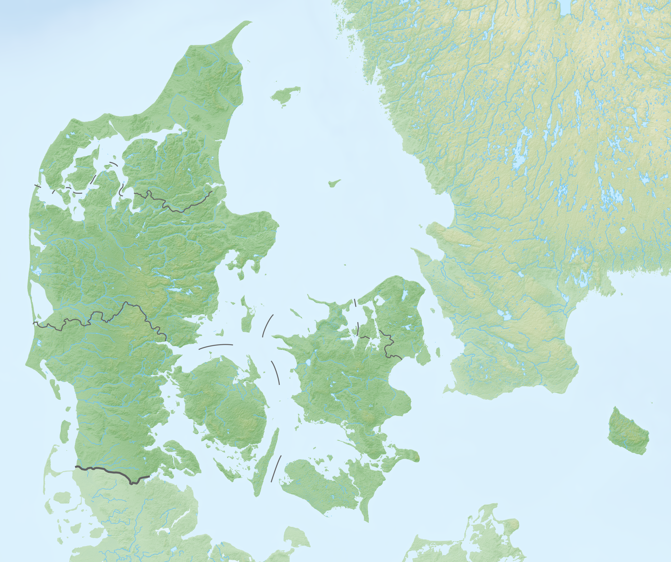
Deutsch: Reliefkarte Dänemark
Topographischer Hintergrund: NASA Shuttle Radar Topography Mission (public domain). SRTM3 v.2. |
||||||||
| Dæta | |||||||||
| Vivàgna | Òpera pròpia | ||||||||
| Aotô | Tschubby | ||||||||
| Licénsa (Dêuviâ tórna 'sto file chi) |
Mi, detentô di driti d'aotô de st'œuvia, deciæo de pubricâla sotta-e seguente lisensie:
Questo file è disponibile in base alle licenze Creative Commons Attribuzione-Condividi allo stesso modo 2.5 Generico, 2.0 Generico e 1.0 Generico
Ti ti pêu çèrne a licénsa che ti ti vêu. |


|
File:Denmark physical map.svg è una versione vettoriale di questo file. Dovrebbe essere usata quella versione al posto di questo file PNG, quando sia migliore.
File:Reliefkarte Dänemark.png → File:Denmark physical map.svg
Per maggiori informazioni, vedi Help:SVG. |
 |
Cronologîa do file
Sciàcca in sce 'n grùppo dæta/ôa pe védde comm'o l'êa o file into moménto indicòu.
| Dæta/Ôa | Miniatûa | Dimenscioìn | Uténte | Coménti | |
|---|---|---|---|---|---|
| prezénte | 22:32, 5 arv 2020 | | 2 538 × 2 126 (5,24 MB) | Tschubby | {{Information |description= |date= |source= |author= |permission= |other versions= }} |
| 10:54, 6 agó 2019 |  | 2 540 × 2 128 (4,86 MB) | Tschubby | {{Information |description= |date= |source= |author= |permission= |other versions= }} | |
| 09:55, 20 màz 2018 |  | 2 541 × 2 128 (4,86 MB) | Tschubby | {{Information |description= |source= |date= |author= |permission= |other versions= }} | |
| 14:58, 7 màz 2018 |  | 2 541 × 2 128 (5,06 MB) | Tschubby | == {{int:filedesc}} == {{Information |Description= {{de| Reliefkarte Dänemark}} Topographischer Hintergrund: [http://www2.jpl.nasa.gov/srtm NASA Shuttle Radar Topography Mission] (public domain). SRTM3 v.2. |Source={{own}} |Date= 2018-05-07 |Author= Tschubby |Permission= {{self|GFDL|Cc-by-sa-3.0-migrated|Cc-by-sa-2.5,2.0,1.0}} |other_versions= }} Category:Location maps of Denmark |
Utilìzzo do file
Nisciùnn-a pàgina a contêgne sto file chi.
Utilìzzo globâle do file
Quésto file o l'é dêuviou da 'ste âtre wiki ascì:
- Dêuviòu inte pàgine de de.wikipedia.org chi de sótta:
- Kattegat
- Großer Belt
- Kleiner Belt
- Amager
- Limfjord
- Mandø
- Trelleborg (Slagelse)
- Saltholm
- Sejerø
- Endelave
- Hesselø
- Langli
- Hammershus
- Christiansø
- Sender Kalundborg
- Sender Søsterhøj
- Trøjborg
- Tunø
- Anholt (Insel)
- Aggersborg
- Fyrkat
- Nonnebakken
- Großer-Belt-Bahntunnel
- Vorlage:Positionskarte Dänemark
- Burg Spøttrup
- Mols (Dänemark)
- Kolindsund
- Nekselø
- Langelandsbelt
- Gedser Odde
- Kategorie:Rennstrecke in Dänemark
- Dankirke
- Dänische Luftstreitkräfte
- Wikipedia:Kartenwerkstatt/Positionskarten/Europa
- Vorlage:Positionskarte Dänemark Syddanmark
- Vorlage:Positionskarte Dänemark Midtjylland
- Vorlage:Positionskarte Dänemark Nordjylland
- Vorlage:Positionskarte Dänemark Sjælland
- Vorlage:Positionskarte Dänemark Hovedstaden
- Hjelm (Insel)
- Dänemark
- Gräberfeld von Himlingøje
- Ølshøj
- Sender Rangstrup
- Køge Bugt
- Sender Gladsaxe
- Søeborg-Sø
- Sender Fünen
- Borgring
- Hvalpsund (Sund)
Véddi l'ûzo globâle de quésto file.