Immaggine:Reliefkarte Vereinigtes Königreich.png

Dimenscioìn de st'anteprìmma chi: 378 × 599 pixel. Âtre resoluçioìn: 151 × 240 pixel | 303 × 480 pixel | 484 × 768 pixel | 646 × 1 024 pixel | 1 292 × 2 048 pixel | 2 825 × 4 478 pixel.
File òriginâle (2 825 × 4 478 pixel, dimensción do file: 7,79 MB, tîpo MIME: image/png)
Detàggi
| Descriçión |
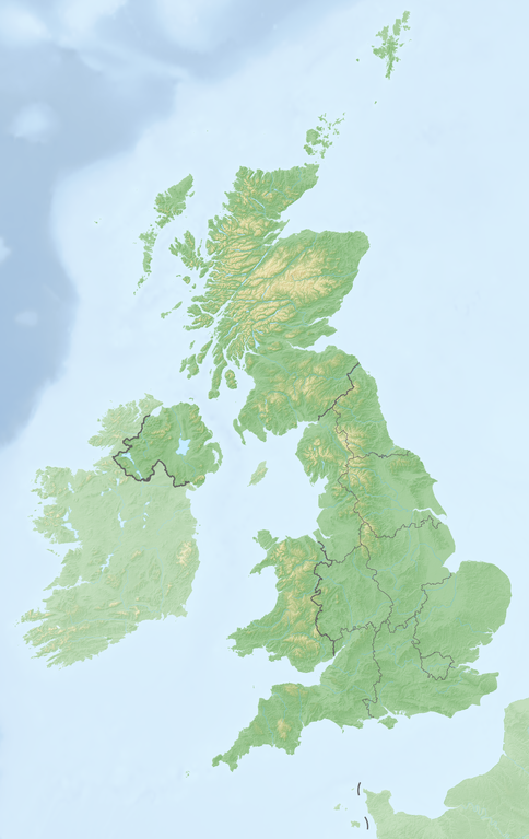
Deutsch: Reliefkarte Vereinigtes_Königreich
Topographischer Hintergrund: NASA Shuttle Radar Topography Mission (public domain). SRTM3 v.2. |
||||||||
| Dæta | |||||||||
| Vivàgna | Òpera pròpia | ||||||||
| Aotô | Tschubby | ||||||||
| Licénsa (Dêuviâ tórna 'sto file chi) |
Mi, detentô di driti d'aotô de st'œuvia, deciæo de pubricâla sotta-e seguente lisensie:
Questo file è disponibile in base alle licenze Creative Commons Attribuzione-Condividi allo stesso modo 2.5 Generico, 2.0 Generico e 1.0 Generico
Ti ti pêu çèrne a licénsa che ti ti vêu. |

Cronologîa do file
Sciàcca in sce 'n grùppo dæta/ôa pe védde comm'o l'êa o file into moménto indicòu.
| Dæta/Ôa | Miniatûa | Dimenscioìn | Uténte | Coménti | |
|---|---|---|---|---|---|
| prezénte | 12:36, 21 màz 2018 | | 2 825 × 4 478 (7,79 MB) | Tschubby | {{Information |description= |source= |date= |author= |permission= |other versions= }} |
| 12:19, 21 màz 2018 |  | 2 826 × 4 479 (7,79 MB) | Tschubby | == {{int:filedesc}} == {{Information |Description= {{de| Reliefkarte Vereinigtes_Königreich}} Topographischer Hintergrund: [http://www2.jpl.nasa.gov/srtm NASA Shuttle Radar Topography Mission] (public domain). SRTM3 v.2.<br /> Grenzen: Spain location map.svg |Source={{own}} |Date= 2018-05-21 |Author= Tschubby |Permission= {{self|GFDL|Cc-by-sa-3.0-migrated|Cc-by-sa-2.5,2.0,1.0}} |other_versions= }} [[Category:Location maps of the United K... |
Utilìzzo do file
A pàgina chi de sótta a contêgne di ligàmmi a sto file chi:
Utilìzzo globâle do file
Quésto file o l'é dêuviou da 'ste âtre wiki ascì:
- Dêuviòu inte pàgine de bg.wikipedia.org chi de sótta:
- Dêuviòu inte pàgine de de.wikipedia.org chi de sótta:
- Großbritannien (Insel)
- Vereinigtes Königreich
- Kanalinseln
- Irische See
- MSF (Zeitzeichensender)
- GBZ (Rufzeichen)
- Sender Lisnagarvey
- Nordkanal (Meerenge)
- Bristolkanal
- Vorlage:Positionskarte Vereinigtes Königreich
- Vorlage:Positionskarte Schottland
- Benutzer:Wiki surfer bcr/Baustellen
- Vorlage:Infobox Burg
- Shepperton
- St.-Georgs-Kanal
- Vorlage:Infobox Burg/Doku
- Vorlage:Positionskarte Nordirland
- Vorlage:Positionskarte England
- Liste der Kernreaktoren im Vereinigten Königreich
- Kategorie:Rennstrecke im Vereinigten Königreich
- Wikipedia:Kartenwerkstatt/Positionskarten/Europa
- Vorlage:Positionskarte Isle of Man
- Vorlage:Positionskarte Wales
- Vorlage:Positionskarte Kanalinseln
- St Donat’s Castle
- Vorlage:Infobox Wasserfall
- Vorlage:Infobox Wasserfall/Doku
- Diskussion:Box Tunnel
- Benutzer:Haigst-Mann/Geschichte DT SW
- Vorlage:Positionskarte Kernkraftwerke im Vereinigten Königreich
- Vorlage:Positionskarte Städte im Vereinigten Königreich
- Britische Formel-4-Meisterschaft 2015
- Carter Bar
- Douglas Tower
- Benutzer:Altkatholik62/Wirral Peninsula
- Liste von Kraftwerken im Vereinigten Königreich
Véddi l'ûzo globâle de quésto file.